Staffordshire and Derbyshire
Please refer to pages 18-22 of the project guide and our interactive map for more information on the proposed project boundary for this section of the route, including route sections 1 to 4 and all associated infrastructure.
Section 1 – Breedon Hope Capture Facility to the North Feeder AGI, south of Chapel-en-le-Frith
Please refer to page 18 of the project guide and our interactive map for more information on our proposals in Section 1 of the project boundary.
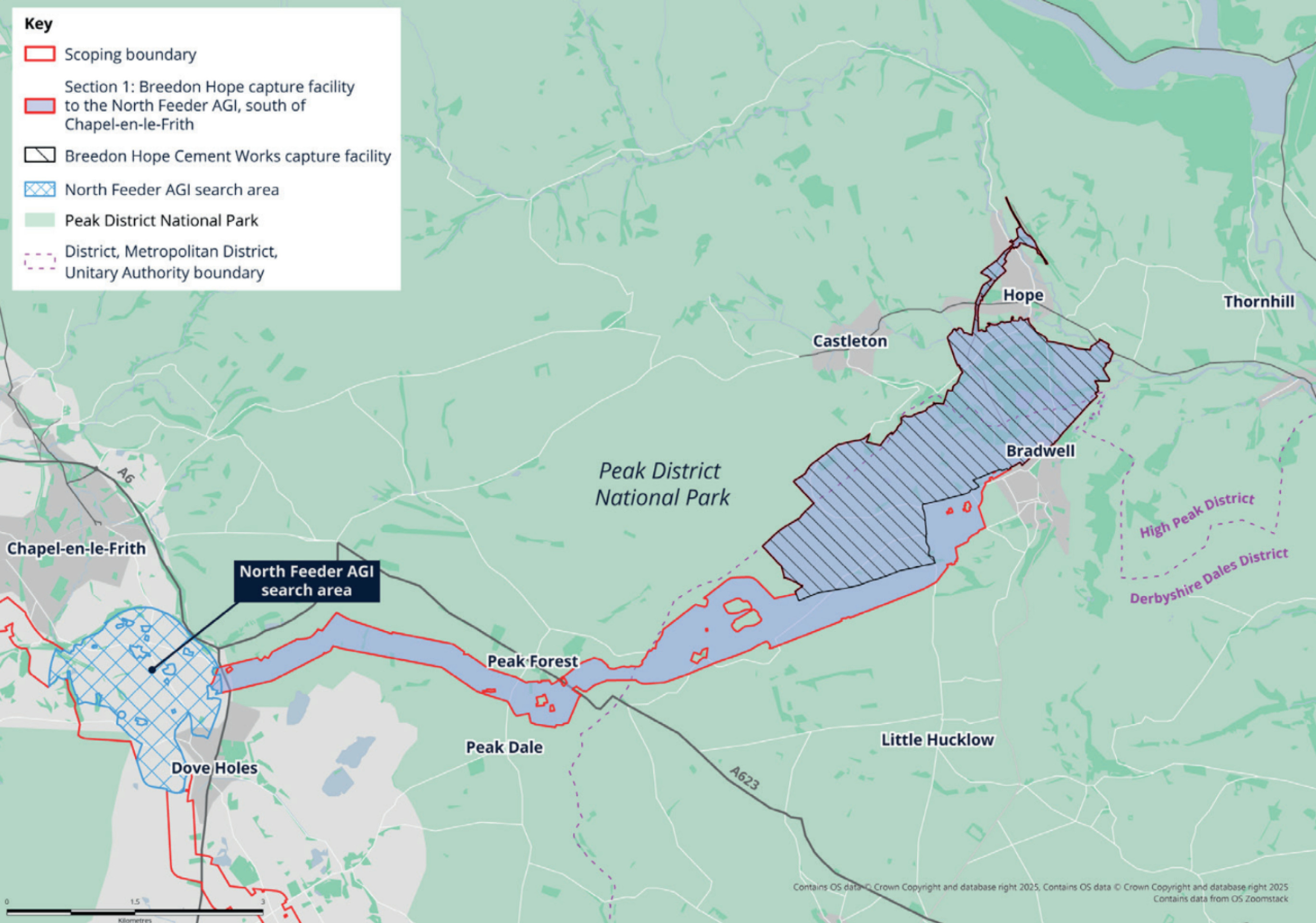
Section 1 explained:
Section 1 includes the Breedon Hope Cement Works Capture Facility (Breedon Hope CCS), which will be built at Breedon’s existing Hope site, in Derbyshire. It also includes part of the pipeline which will carry captured CO2 to the North Feeder AGI, located to the south of Chapel-En-Le-Frith.
This section spans Derbyshire Dales District Council, High Peak District Council, Derbyshire County Council, the Peak District National Park Authority and the East Midlands Combined County Authority.
Do you have any comments on our proposals within this section?
Section 2 – Tarmac and Buxton Lime Tunstead capture facilities, to and including the North Feeder AGI, south of Chapel-en-le-Frith
Please refer to page 19 of the project guide and our interactive map for more information on our proposals in Section 2 of the project boundary.
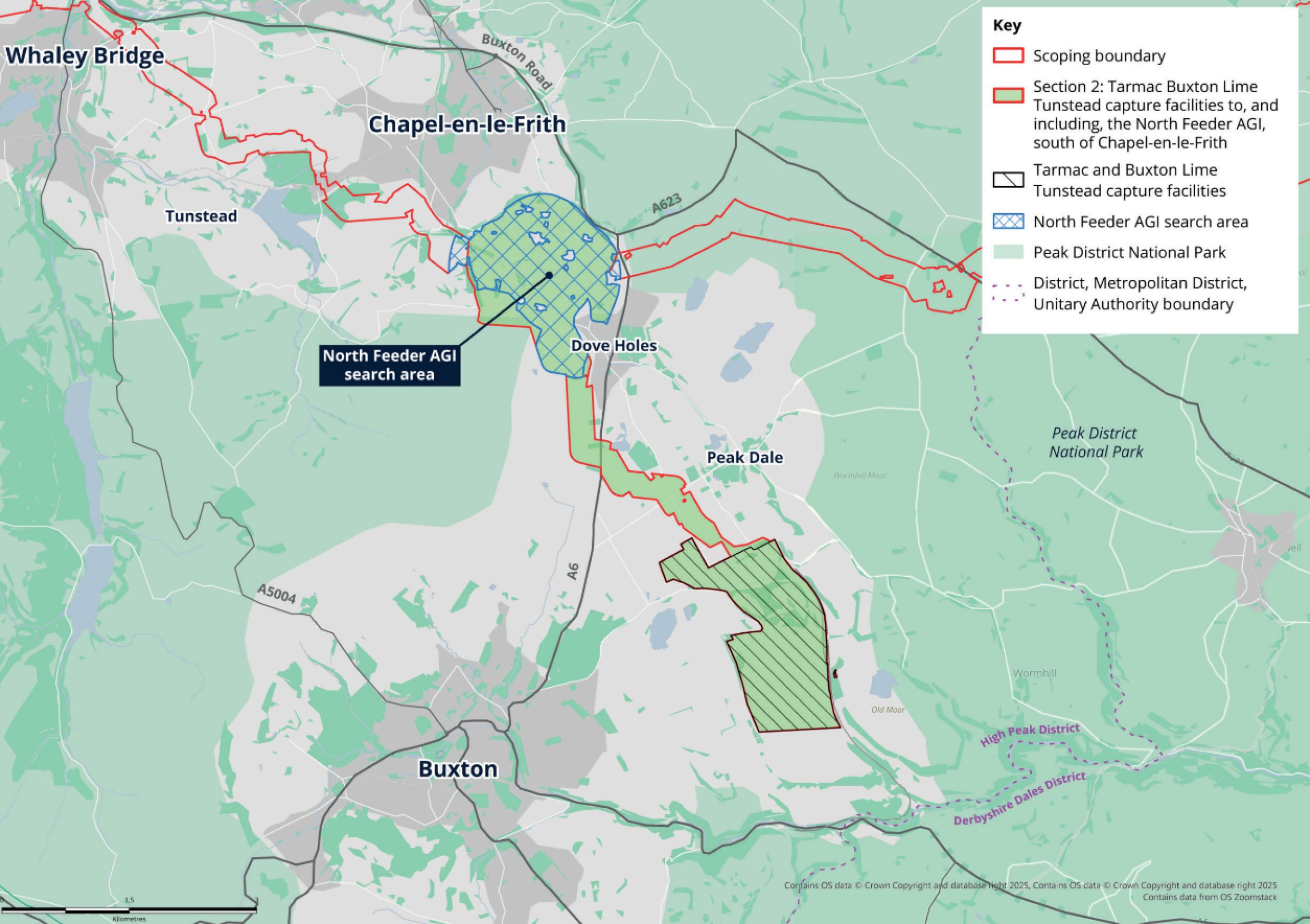
Section 2 explained:
Section 2 includes the Tarmac Tunstead Cement Works capture facility Tarmac Tunstead CCS, and the Buxton Lime capture facility, Buxton Lime CCS located at Tarmac’s Tunstead site, to the north east of Buxton, in Derbyshire. This section also includes the North Feeder AGI, located to the south of Chapel-en-le-Frith, and the pipeline connecting the capture facilities to this.
This section spans High Peak District Council, Derbyshire County Council and the East Midlands Combined County Authority.
Do you have any comments on our proposals within this section?
Section 3 – Pipeline from the North Feeder AGI, south of Chapel-en-le-Frith to the Cental Feeder AGI, south west of Macclesfield
Please refer to page 21 of the project guide and our interactive map for more information on our proposals in Section 3 of the project boundary.
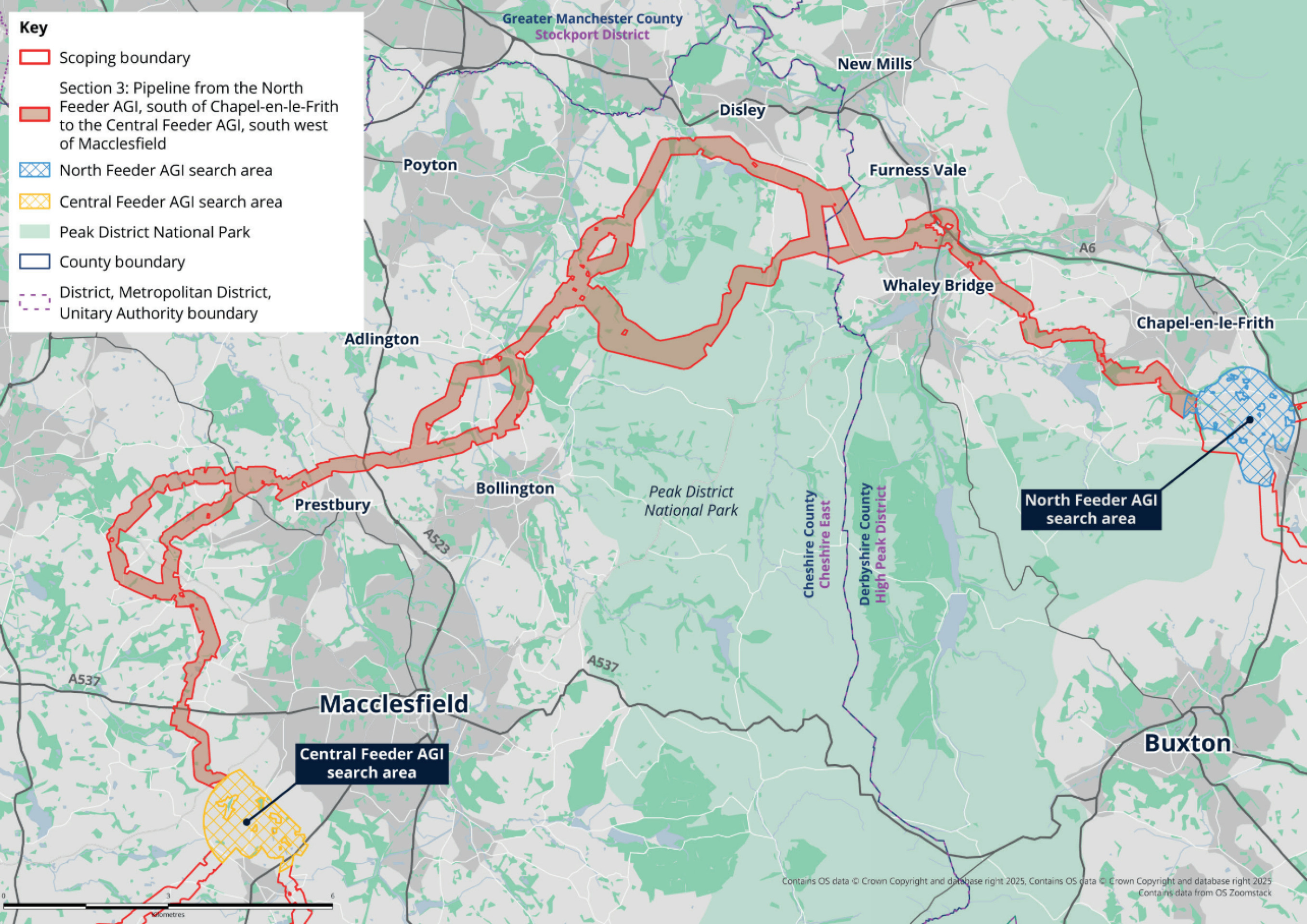
Section 3 explained:
Section 3 includes the pipeline which runs from the North Feeder AGI, located to the south of Chapel-en-le-Frith in Derbyshire, through to the Central Feeder AGI, south west of Macclesfield.
This section spans High Peak Local Authority, Derbyshire County Council, Cheshire East Council, Peak District National Park Authority and the East Midlands Combined County Authority.
In this section, we have identified different options for the pipeline route. We will use your feedback to refine our plans to one preferred option.
Do you have any comments on our proposals within this section?
Section 4 – Holcim Cauldon capture facility to the Central Feeder AGI, south west of Macclesfield
Please refer to page 22 of the project guide and our interactive map for more information on our proposals in Section 4 of the project boundary.
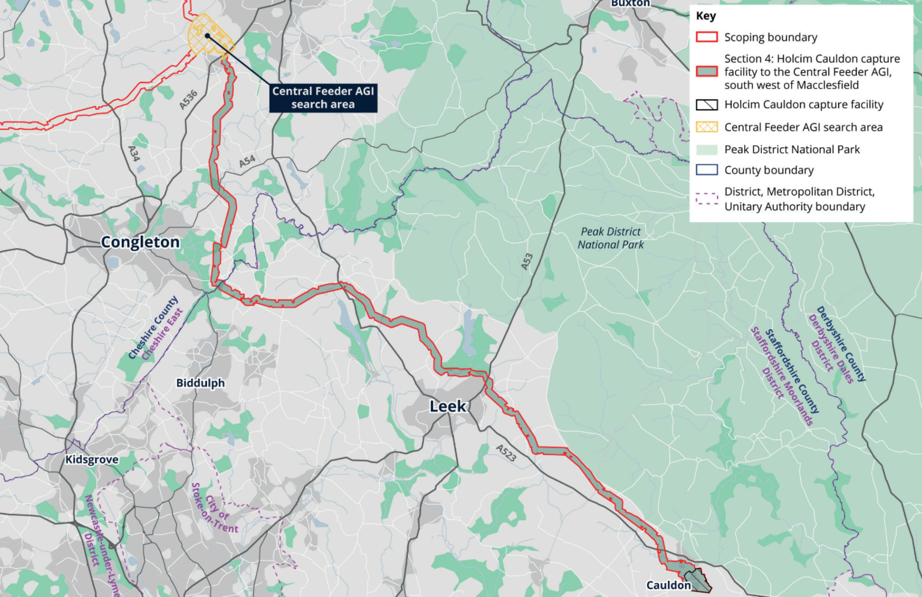
Section 4 explained:
Section 4 includes the Holcim Cauldon capture facility Holcim Cauldon CCS, located near Cauldon, Staffordshire, and the pipeline which passes north of Leek and Congleton, before it reaches the Central Feeder AGI, south west of Macclesfield.
This section spans Staffordshire County Council, Staffordshire Moorlands District Council and Cheshire East Council.
Do you have any comments on our proposals within this section?